One of great advantage of having a 3D model of the terrain is that it becomes possible for the viewer to change freely the point of view and literally fly over the scene. Since the 3D models reflect the topography of the terrain It also permits scientists, mission controllers and the general public to map, measure, and investigate the landing site as if they were there with a meter stick.
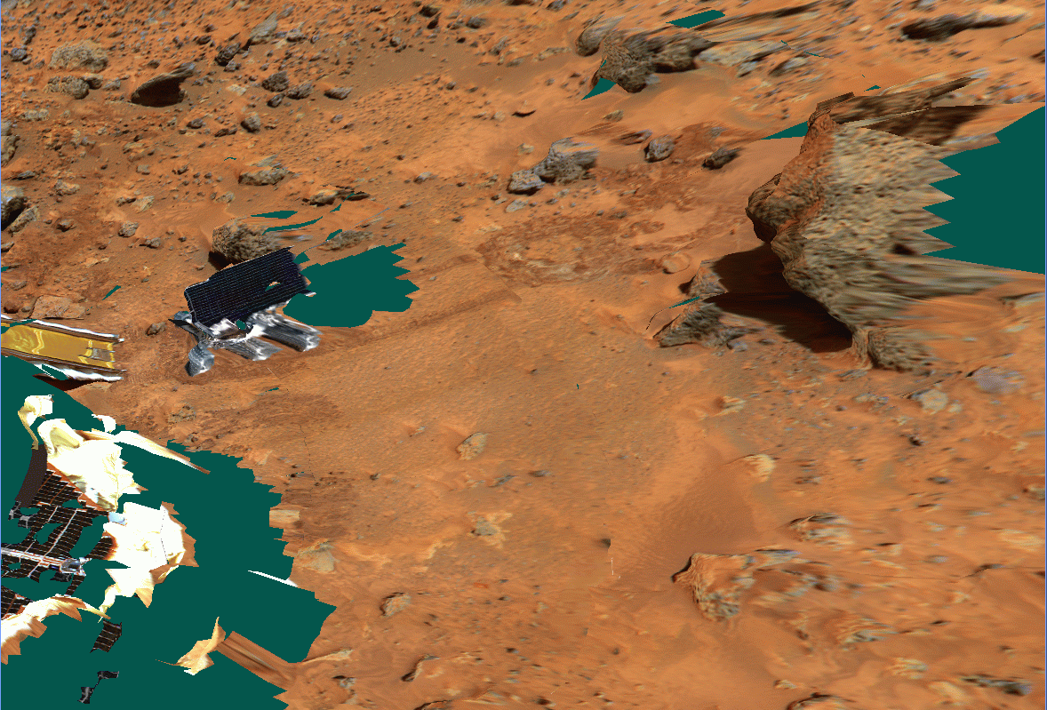
On this image we can see the sojourner rover as it was located at the end of sol 2 (July 5 1997) and the well known rock Yogi. The lander's airbags and back ramp are visible on the left side of the image. The green areas are occluded areas from the camera point of view for wich no data were aviable during the mission.

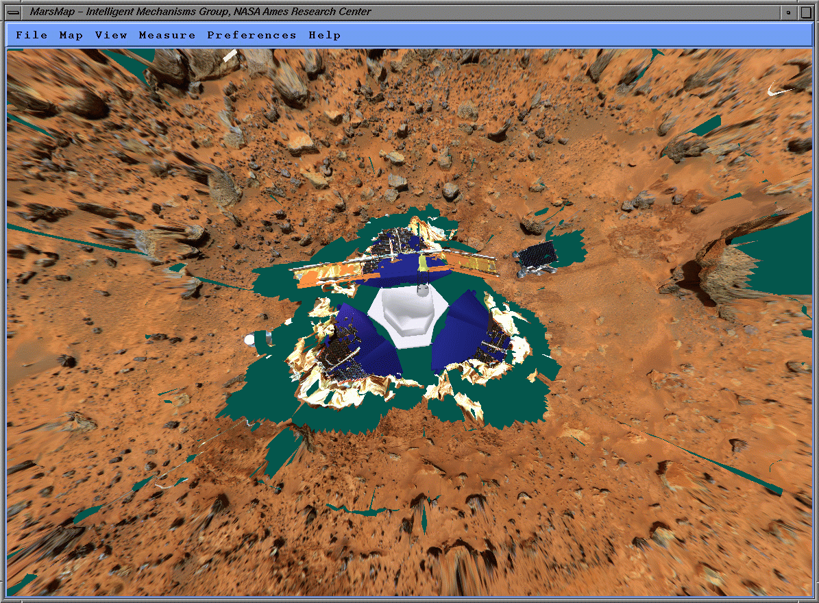
On this view the Lander is visible at the center of the image. The rover Sojourner just got off the back ramp and is located at 2 o'clock relatively to the lander while the north direction is approximately at 4 o'clock. The green area are zone where the data were not aviable because of occlusions from the camera point of view.
Projection of rover images onto billboard placed and oriented accordingly to the rover location at the time of imaging. On this particular screen dump we can clearly see the overhang under Yogi (the big rock in the top right portion of the image) on both the billboard and the photorealistic terrain model.
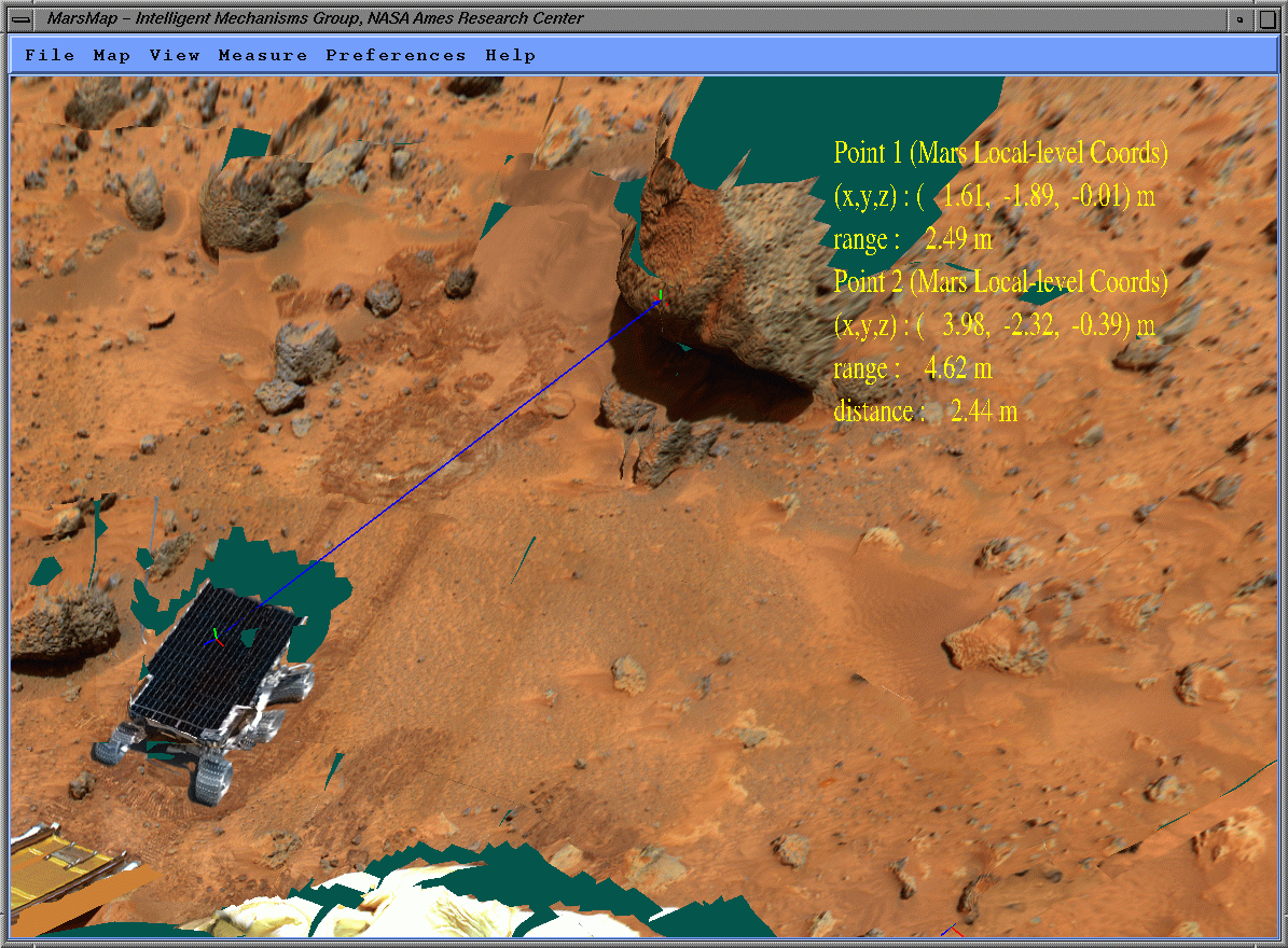
This image shows the measurement of the distance between the rover sojourner and the rock Yogi. Yogi is about 1 meter (3 feet) accross and is located 5 meters (15 feet) from the Lander Cameras. The track on the ground past sojourner are due to the fact that the color texture overlayed onto the terrain has not been taken at the same time as the stereo images used to generate this model
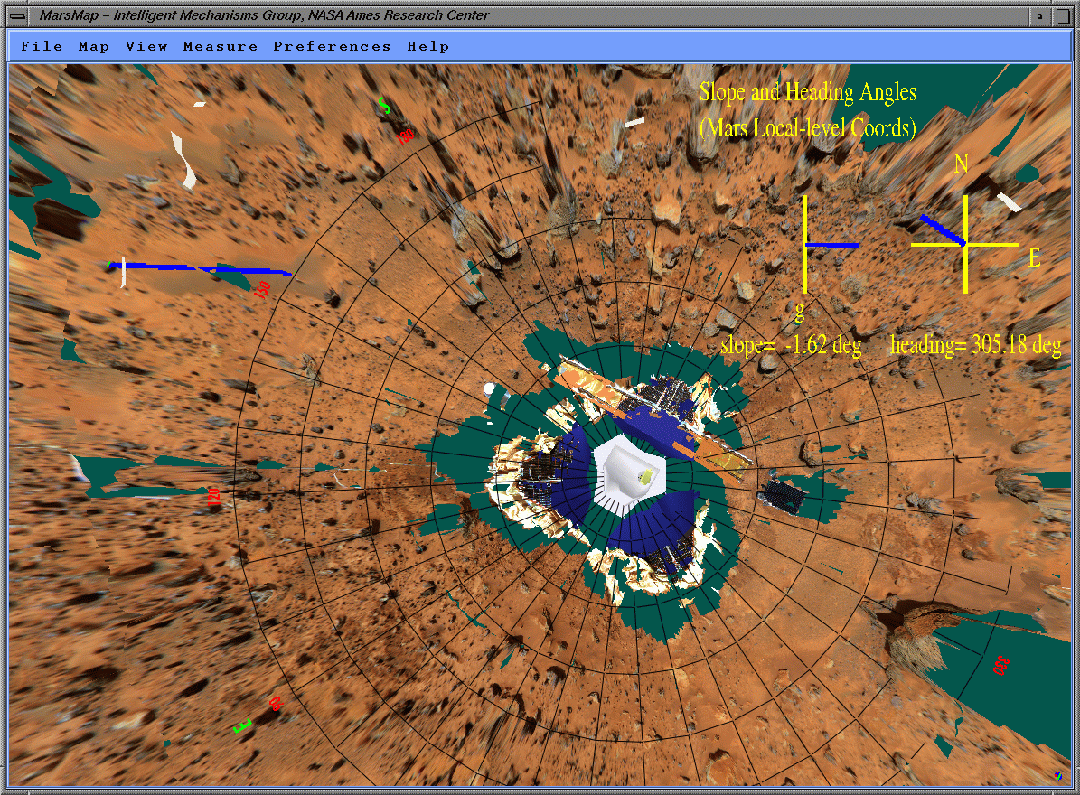
Marsmap also allows to measure azimuth and slope angles. On this example the azimuth of Mairmaid dune (at 10 o'clock). Those measurements as well as the measurements of the wind tail (sand deposits) behind the major rocks confirmed the observations done by satellite about the dominent wind direction.
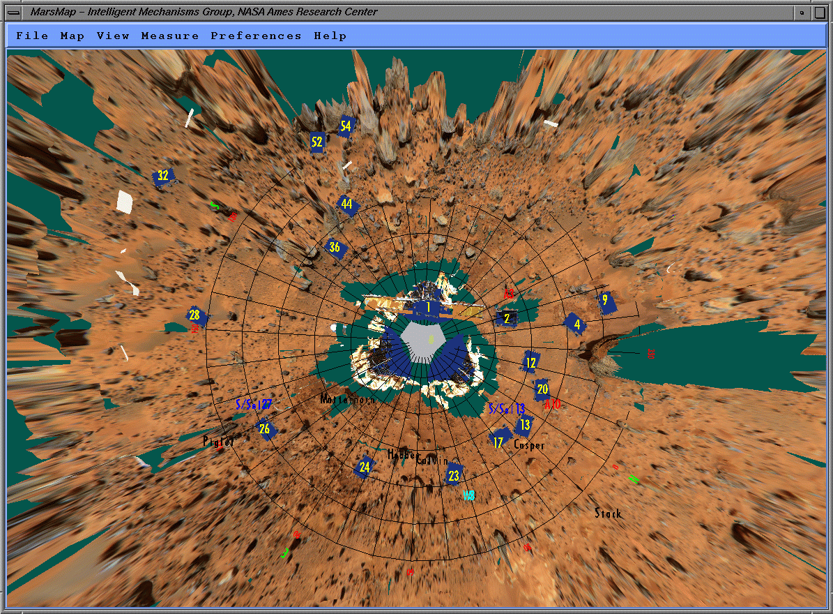
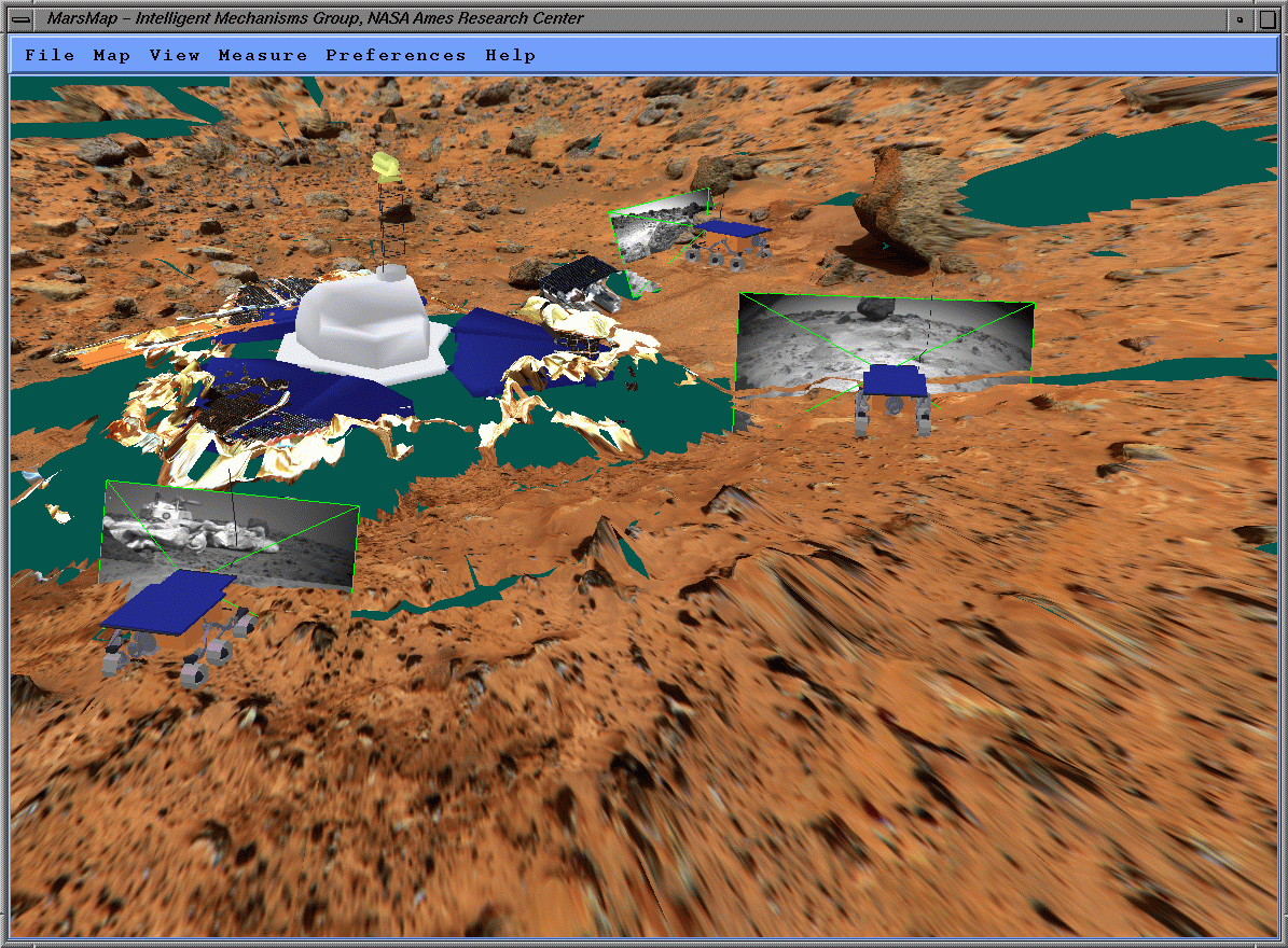
This image shows the visualisation of archived data with the terrain model. The blue rectangles represent the rover position, the number indicate the sol (martian day). The red A/ indicate the location of the APXS measurements, Also visible are a couple of rock's name and soil mechanics experiments.
|
Last Updated: Saturday, October 24, 1998 by Eric Zbinden |
Email:
zbinden@artemis.arc.nasa.gov |