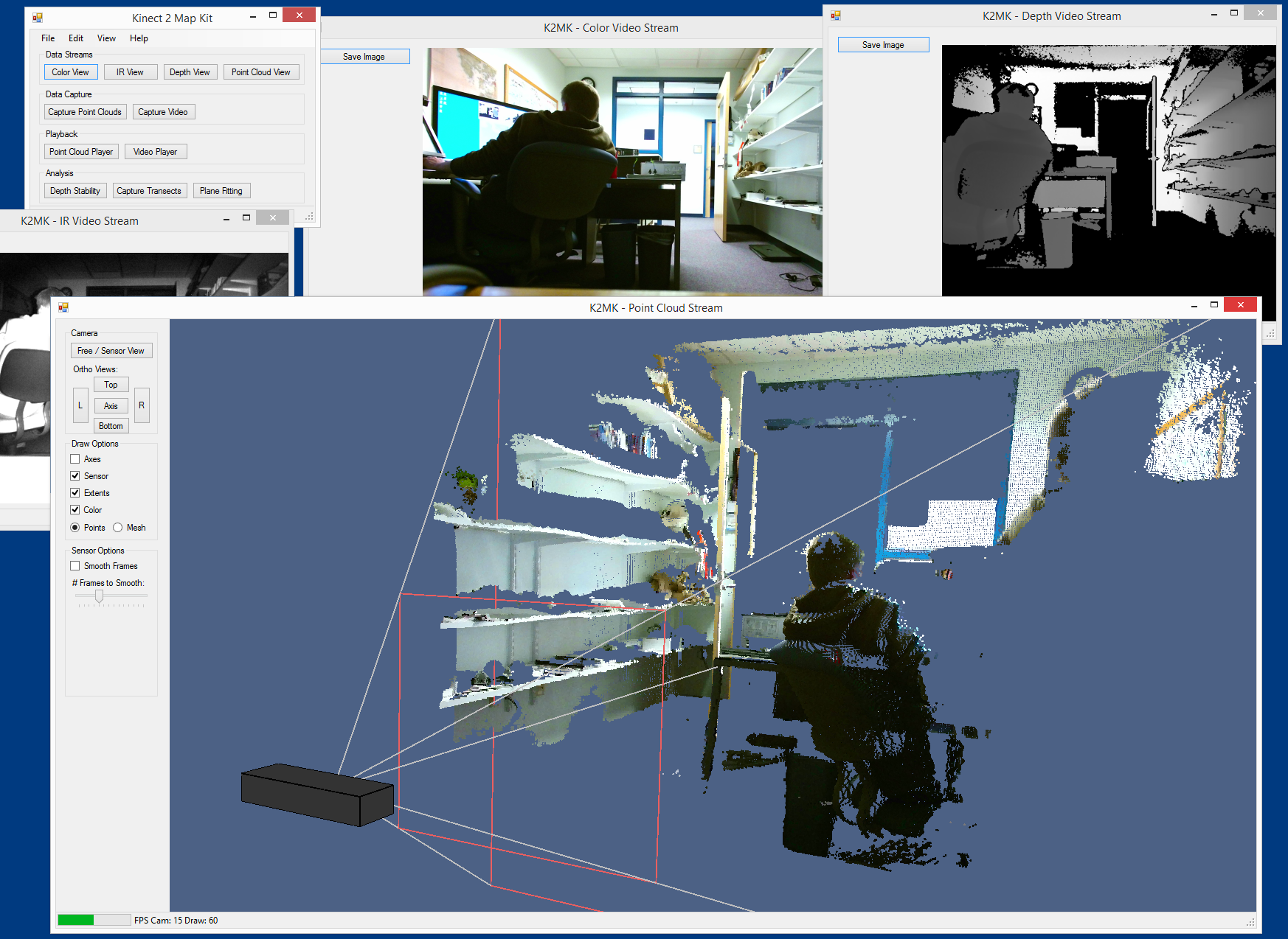
K2MapKit
Kinect for Windows v2 Map Kit
Thomas Butkiewicz, Ph.D.

Center for Coastal and Ocean Mapping
University of New Hampshire
Requirements:
Download the latest version:
K2MapKit v1.21 (June 4th, 2015)
Instructions:
- Download latest version
- Unzip archive to desired folder
- Plug in Kinect for Windows v2 sensor
- Run K2MapKit.exe
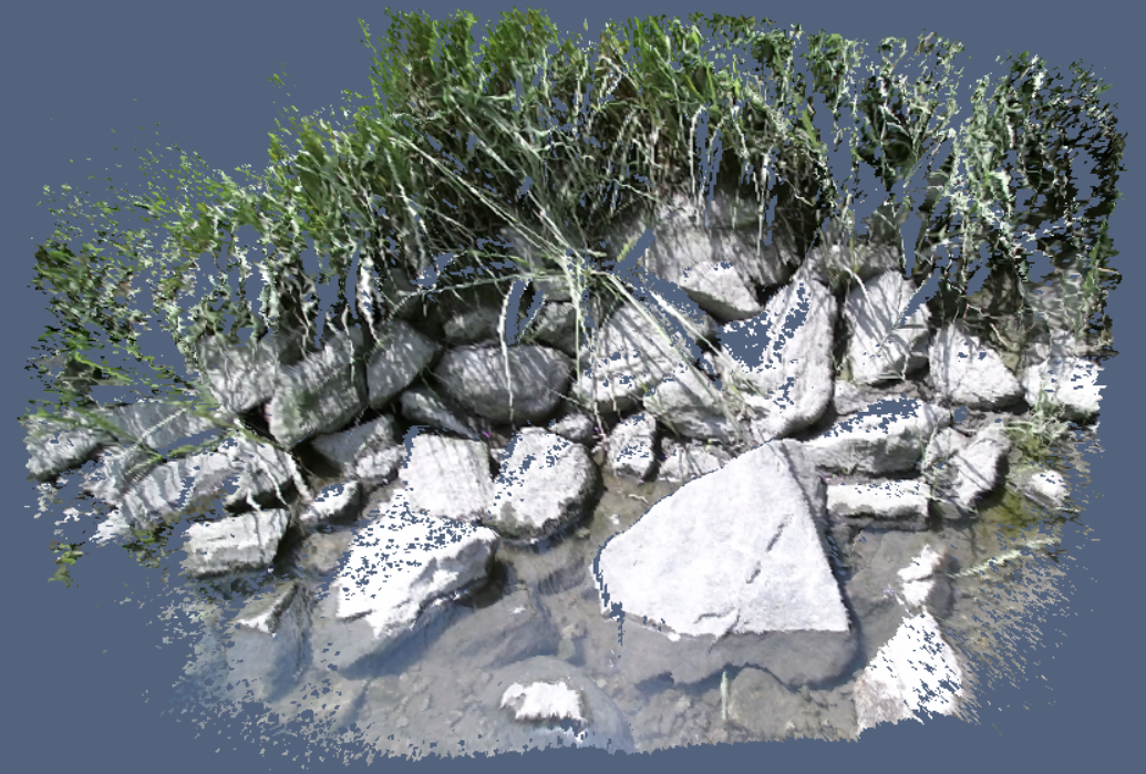
To Capture 3D models:
- Click "Point Cloud View" button
- For noise reduction: (Optional but recommended)
- Use tripod or otherwise keep Kinect sensor still while pointed at target
- Check the "Smooth Frames" box
- Set "# Frames to Smooth" slider to maximum (all the way to the right)
- Click "Export Mesh to .ply" button
- Select directory to save into
- Repeat click on Export button for each additional capture
- Resulting .ply files can be opened with programs such as MeshLab