Photorealistic Terrain Modeling
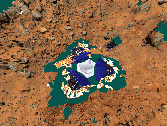
Photorealistic terrain model of the Pathfinder landing site
Photorealistic terrain model of the Pathfinder landing site
The objective of this project is to provide the operation and
science teams of NASA planetary surface missions with improved
visualization of their remote worksites. The goal of this research is
to provide these teams with a photo-realistic topographic model of
their surface mission at downlink rates and deliver the capability to
automatically process stereo imagery from the remote ground system
into photo-realistic topographical models of the terrain at the remote
worksite. These models consist of accurate three dimensional terrain
reconstructions registered with their source imagery.
|
Last Updated: Oct 2002 by Kurt Schwehr Modified Oct 2001 - mirrored to schwehr.org img no longer has a web server. |
Email:
zbinden@artemis.arc.nasa.gov or schwehr@cs.stanford.edu |
Just found a very extensive tutorial on 3D from images by Marc Pollefeys: Tutorial
-kurt