 |
      |
Introduction to
Marine Geophysical Data Processing
Sample Course Syllabus
This course is designed for the upper division geology and geophysics
student or beginning graduate students. The aim of the class is to
provide students with a survey of data processing techniques used in
marine geo sciences. Students will have enough knowledge to be able
to find additional materials when they have to use these types of data
in their careers. Students should be more comfortable in advanced
theory courses after completing this class.
Each section of the class, we will discuss the basic operation of an
instrument or technique. How does it work. What are the strengths
and weaknesses of the technique. This will be at a high level and will
not require extensive theory or math. We will then walk through the
steps of processing the data. For the lab/homework, you will take raw
data from each particular system and process a sample data set. You
will be expected to know enough that you could help with each type of
data collection in the field. Many of these techniques can be used
for land based geology in addition to the marine environment.
Prerequisites
- Structural Geology
- Stratigraphy and Sedimentology
- One semester each of calculus and physics
- Access to a workstation with X11. (e.g. MS Windows with cygwin, Mac OSX with Apple's X11, or Linux)
- Students may use their own Mac OSX computer with fink or log on to the department's computer for the class.
Field trip (varies by year)
- NASA Glenn - Earth Observing
- TRW
Texts
- Required
- Marine Geophysics by E.J.W. Jones
- Online or recommended
- GMT Tech Reference & Cookbook by Paul Wessel & Walter Smith
- MB-System Cookbook by Val Schmidt
Grading
- There will be one combined lab and homework project each week
- Each student will give a short presentation at the end of the
semester using on the tools presented in the class. (Other tools with
instructor approval)
- A short 4 page paper will accompany the presentation. You will
detail the methods and techniques and provide figures that show the
end results. What parts were hard or especially easy? What do you as
a geologist see in the data?
- One script that fetches all your data and does all non-human processing.
- One midterm
- One final
Schedule
- Week 1 - Life as a sea or lake going researcher
- Living and safety of a ship
- Interacting with the crew and marine technicians
- What kinds of studies are done
- Applying for ship time
- Week 2 - Introduction to Unix
- Introduction to Mac OSX / Unix
- Using fink
- Learn how to edit files, write simple shell scripts
- Using ssh, sftp, WinSCP, fugu, and wget to move data and scripts
- Week 3 - GPS
- How does the GPS constellation work
- Differential, Phase, P-Code
- How accurate will my measurements be?
- A bit of history: dead reckoning through Loran
- Measure USGS benchmarks
- Using gnuplot
- GPS is more than just knowing where you are
- Week 4 - Generic Mapping Tool
- Introduction to GMT and ghostview
- Working with points and lines
- Making a basemap with lines and points on top
- Week 5 - Gravity and Magnetics (GMT cont.)
- How does a towed magnetometer work
- Seeing floor spreading
- What is predicted topography
- Using Smith and Sandwell's predicted topography
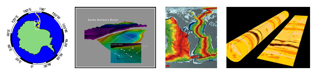
- Week 6 - Multibeam swath bathymetry
- Theory of operation
- Sources of noise. What causes bad pings
- Correcting for water temperature
- Using mbsystem to ping edit
- Week 7 - Sidescan sonar
- Basic principles of sidescan and backscatter
- Using xsonar to processes sidescan
- Midterm
- Week 8 - Chirp Seismics
- Basic theory about single channel chirp systems
- What is segy
- Basic processing with seismic unix (su)
- Week 9 - Coring
- What are the types cores: box, gravity, caston, piston, rotory
- What is each type good for?
- How to process
- Processing core photographs and descriptions (using xcore)
- Ground truth for seismics and sidescan
- Week 10 - Multisensor tracks
- GRAPE
- Resistivity
- Susceptibility
- Velocity
- Week 11 - Well logging tools
- Ocean drilling program
- Resistivity
- Crack directions
- Putting it all together
- Week 12 - Acoustic Doppler Current Profilers
- Knowing about currents and water flow
- What does this measurement in time mean?
- Week 13 - ROVs and Submersibles
- What are the limiting factors
- Navigation
- Tools and tasks
- Week 14 - Paleomagnetic Data
- Sampling
- Natural Remnant Magnetization
- Anisotropy of Magnetic Susceptibility - what is a normal fabric?
- Week 15 - Student presentations
- Extra lab for help on your projects
- Each student will present to the class
- Final
|
| © 2004 Kurt Schwehr |
|
|